Picacho State Recreation Area
Information from Parks.ca.gov
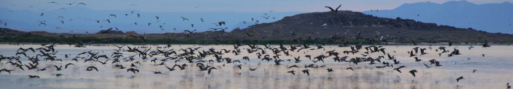
 100 years ago Picacho was a gold mining town with 100 citizens. Today the site is a State Park, popular with boaters, hikers, anglers and campers. The park offers diverse scenery, including beavertail cactus, wild burros, bighorn sheep and thousands of migratory waterfowl. (The park is on one leg of the Pacific Flyway.) Eight miles of the lower Colorado River are the recreation area’s eastern border.
As in any desert country, travelers on this road should carry extra water and other essential supplies. All motor vehicles are required to stay on the authorized routes of travel in the recreation area. In case of trouble it is best to keep calm and remain near your vehicle and in the shade until help arrives.
Location Directions
Take the 24-mile (mostly unpaved) road north from Winterhaven near the Mexican border. The road to Picacho from Winterhaven is paved only for the first 6 of 24 miles. The last 18 miles is over a dirt road that is passable for cars and vehicles with trailers and motorhomes. At times during the summer thunderstorms are likely to cause flash flooding in the washes, temporarily making short sections of the road impassable.